Sierra Leone Urban Research Centre
  • ABOUT
    • News
    • Media
    • How we Work
    • Our People >
      • SLURC Team
      • Board of Directors
      • International Advisory Committee
      • Champions
  • RESEARCH
    • Urban Health >
      • Future Health Systems
      • ESRC Shock Tactics
      • ARISE
      • AT 2030
      • Ebola Virus Disease Response and Resilience
    • Urban Livelihoods and the City Economy >
      • Urban Livelihoods in Freetown’s Informal Settlements
    • Urban Vulnerability and Resilience >
      • Humanitarian Responses and Empowerment Outcomes in Informal Settlements
      • Building Collective Capacity to Disrupt Urban Risk Traps
    • Land and housing >
      • Community Action Area Planning and Change by Design
      • KNOW: Knowledge in Action for Urban Equality
    • Urban mobility >
      • T-SUM: Transitions to Sustainable Urban Mobility
      • AT 2030
  • PUBLICATIONS
    • Blog
    • Newsletters
    • Briefs
    • Reports
    • Video
    • Audio
  • TRAINING & WORKSHOPS
  • URBAN RESOURCES
    • Urban Data Portal
  • CONTACT
    • Current Vacancies

Mapping for change - hazards, vulnerabilities and capacity to act in Freetown

Picture
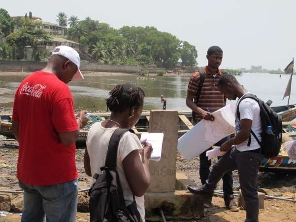
​A three-day capacity building workshop 15-17th March 2017 on building collective capacity to disrupt urban risk traps to enhance the capacity of local disaster risk management structures in Freetown, Sierra Leone in order to monitor and document the processes that drive risk accumulation over time and to appraise the practices deployed and resources mobilized to mitigate, reduce and prevent risk has just been concluded.
The workshop was attended by 40 participants including informal settlements community residents, Federation of the Urban and Rural Poor (FEDURP), Disaster Management Department, Environmental Protection Agency and NGOs.
In summary, the objectives of the training delivered were:
  • To corroborate the boundaries of informal settlement, administrative areas and wards.
  • To consolidate and validate the knowledge produced so far by SLURC in relation to the hazards and vulnerabilities affecting informal settlements in Freetown and any existing information at ward level.
  • To identify and evaluate the capacity to mitigate, reduce and prevent risk of local organizations, individual households and state agencies.
  • To equip participants with skills to map (both manually and through mobile processing application like Ramblr) and systematically monitor the above conditions through the tool ReMapRisk.
During the workshop, mapping of the settlement was undertaken in two informal settlements, both in the west of the city, namely, Dworzark, a hillside community, and Cockle Bay, a coastal community. At the community level, the team brought together men and women from each of the two settlements, to discuss and decide where to map, why and how, as a way to apprehend their community profile, infrastructure, capacity to act and a means to document and monitor how risk accumulation cycles or ‘urban risk traps’ materialize over time and where, feeding feed spatial and temporal details into an interactive online database about specific hazards, who is affected, where, how and why. The fieldwork exercise tested various participatory tools such as focus group discussion, mapping using smart phones and applications such as 'Ramblr' to collect data that feed the information gathered into ReMapRisk. 

​

Email: 

info@slurc.org


Telephone:

+232 22 220 986
Sign up for our quarterly newsletter


Staff Login
All rights reserved Copyright © 2019 SLURC. Website design by  Planning Green Futures. Powered by Softcom Multimedia